Data Sources
The data sources used are documented in detail here: IO-XPA Data Processing
1. Accidents and Incidents
The main data used in IO-AVSTATS is provided by the National Transportation Safety Board. On the accident data page is the link Downloadable data sets, which contains the aviation accident data in MS Access format for free download.
File |
Created (mm/dd/yyyy) |
Description |
|---|---|---|
avall.zip |
current |
Data from January 1, 2008 to today |
PRE1982.zip |
10/27/2020 |
unknown |
Pre2008.zip |
09/30/2020 |
Data from January 1, 1982 to December 31, 2007 |
upDDMON.zip |
current |
New additions and updates until DD day in the month MON |
The schemas of the two databases avall and Pre2008 are identical except for the two new optional columns dec_latitude and dec_longitude in the database table events of the database avall.
1.1 Database Schema Comparison
Before any new NTSB data set can be processed, the database schema of the new data set must first be compared with the database schema of the previous version of the NTSB data set avall.mdb.
Procedure:
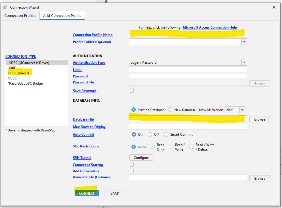
The RazorSQL program is started.
Under ‘Connections’ select ‘Add Connection Profile’.
Select MS Access under Add Connection Profile.
Connection Type is ODBC (Direct).
In addition, an entry must be made at Connection Profile Name and Database File: - Connection Profile Name: IO-AVSTATS - Database File: IO-AVSTATS.mdb
After pressing the CONNECT button you will be connected to the selected MS Access database.
After opening the database, a SQL script with the DDL statements can be generated in the menu under DB Tools and Generate DDL.
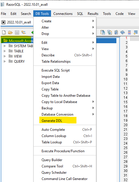
This SQL script can be saved as a file for further processing in the menu under File and Save As.
In case of any discrepancy, these must be implemented into the existing PostgreSQL database.
1.2 Table Processing Order
Based on the foreign keys (FK) present in the database schema, the following processing sequence results when creating the database schema and loading or updating the database tables:
Level 1 - without FK - events
Level 2 - FK: ev_id - aircraft - dt_events - NTSB_Admin
Level 3 - FK: ev_id & Aircraft_Key - dt_aircraft - engines - Events_Sequence - Findings - Flight_Crew - injury - narratives - Occurrences
Level 4 - FK: ev_id & Aircraft_Key & crew_no - dt_Flight_Crew - flight_time
Level 4 - FK: ev_id & Aircraft_Key & Occurrence_No - seq_of_events
1.3 Issues
The problem database tables listed below are not included in the PostgreSQL database schema.
A) Empty database tables
The following database tables are included in the Entity Relationship Diagram (ERD), but they do not contain any data in the database: - Occurrences - seq_of_events
B) Legacy database tables
The following database tables are included in the database but are missing from the ERD: - Country - ct_iaids - ct_seqevt - eADMSPUB_DataDictionary - states
C) Inconsistent database data - foreign key
database table ntsb_admin: database table event has no row with ev_id = 20210527103155 (data source: avall.zip) - as a consequence, the foreign key to the events table had to be removed
D) Inconsistent database data - country USA and state
SELECT ev_state,
       count(*)
FROM events
WHERE ev_country = 'USA'
  AND NOT ev_state IN (SELECT state
                         FROM io_states ius)
GROUP BY ev_state
ORDER BY ev_state
ev_state |
count |
|---|---|
AO |
17 |
CB |
1 |
GM |
45 |
GU |
8 |
OF |
14 |
PO |
15 |
PR |
112 |
UN |
3 |
VI |
6 |
E) …Inconsistent database data - invalid USA latitude
SELECT count(*)
  FROM io_lat_lng_issues
 WHERE io_dec_lat_lng_actions LIKE '%ERROR.00.920%'
count |
|---|
430 |
F) Inconsistent database data - invalid USA longitude
SELECT count(*)
  FROM io_lat_lng_issues
 WHERE io_dec_lat_lng_actions LIKE '%ERROR.00.921%'
count |
|---|
462 |
2. Airports and Runways
2.1 FAA Airports
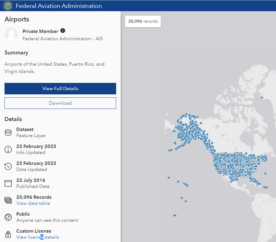
The FAA provides data on airports in the United States in the form of a csv file. This data is updated by the FAA at irregular intervals.
2.2 FAA Runways
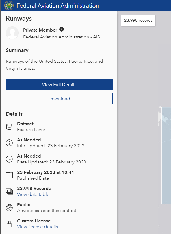
The FAA provides data on runways in the United States in the form of a csv file. This data is updated by the FAA at irregular intervals.
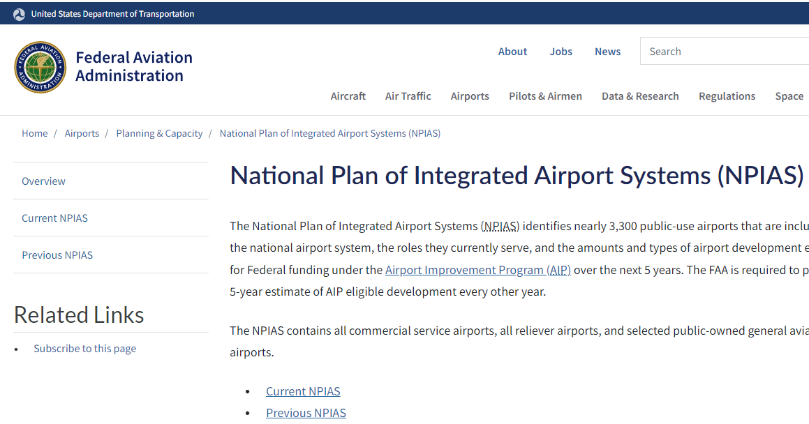
2.3 National Plan of Integrated Airport Systems (NPIAS)
The FAA provides data on preferred airports in the United States in the form of an MS Excel file. This data is updated by the FAA at irregular intervals.
3. AVIATION OCCURRENCE CATEGORIES
The CICTT codes used in the `Aviation_Occurrence_Categories/aviation_occurrence_categories.xlsx` file is taken from this document.

4. Countries
This repository contains a list of world countries, as defined by ISO Standard 3166-1, in JSON, CSV, XML and YAML.
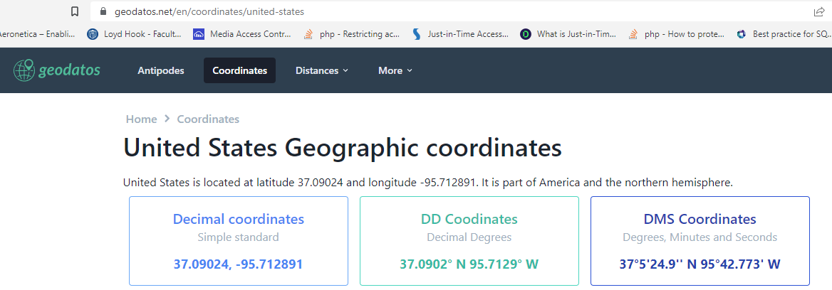
4.1. geodatos
The decimal latitude and longitude for the USA used in the `Countries_States/countries_states.json` file is taken from the geodatos website.
5. Look-up Tables
This document outlines the lookup tables used within the Streamlit application. These tables provide standardized codes and descriptions for various categories, events, modifiers, phases, sections, subcategories, and subsections related to aviation accidents and incidents, ensuring consistent data management and analysis.
io_md_codes_category from findings (category_no, finding_description)
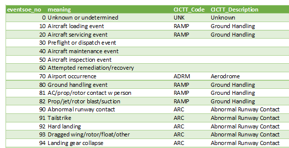
io_md_codes_eventsoe from events_sequence (eventsoe_no, occurrence_description)
io_md_codes_modifier from findings (modifier_no, finding_description)
io_md_codes_phase from events_sequence (phase_no, occurrence_description)
io_md_codes_section from findings (category_no, subcategory_no, section_no, finding_description)
io_md_codes_subcategory from findings (category_no, subcategory_no, finding_description)
io_md_codes_subsection from findings (category_no, subcategory_no, section_no, subsection_no, finding_description)
6. Sequence of Events
The content of the database table io_sequence_of_events is created based on the following csv file. The file was provided to Loyd by the NTSB.
7. simplemaps
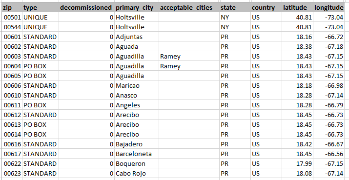
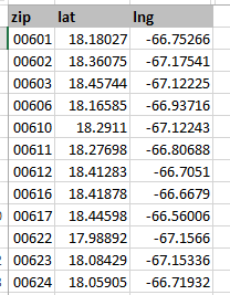
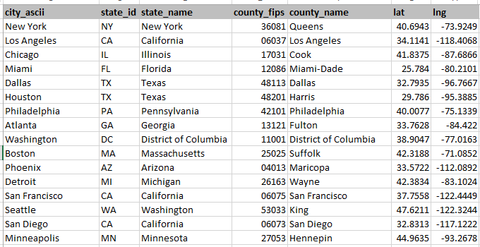
In order to fill in the missing decimal latitudes and longitudes, free available data from simplemaps is used. simplemaps offers postal codes and cities with their latitude and longitude.
The US Zip Codes Database link provides latitude and longitude for selected US zip codes:
The United States Cities Database link provides latitude and longitude for selected US cities:
8. States
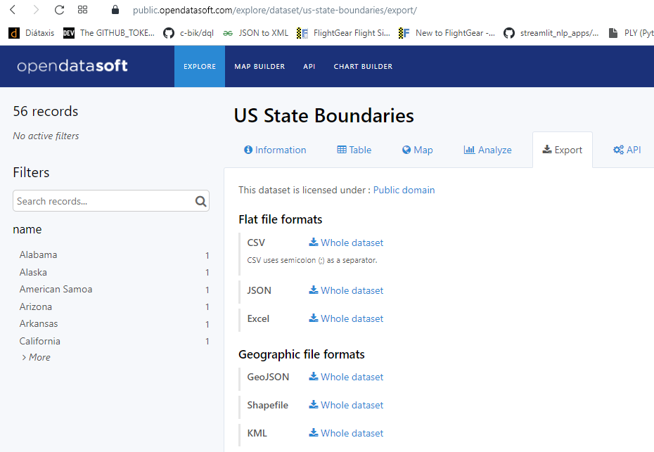
The decimal latitudes and longitudes for the US states used in the `Countries_States/countries_states.json` file are taken from the opendatasoft website.
9. United States Zip Codes.org
In order to fill in the missing decimal latitudes and longitudes, free available data from United States Zip Codes.org is used. United States Zip Codes.org offers more complete postal codes but only with estimated latitudes and longitudes.